I was still feeling like my feet had been walking across a hot road, a little tender in places, but much better compared to the night before. My GPS wanted to take me to New Plymouth the boring way and I wanted to go on the much more aptly named “Forgotten World” highway. I figured signs would show me the way and I headed north with Mt Doom and Mt Tongariro still covered in cloud. I drove to the Raurimu spiral (I’m surprised it is not on my Dad’s bucket list) but failed to find a viewpoint of the spiral train track. Eventually, a turn off for the Forgotten World Hwy appeared and off I drove in search of something amazing.
The highway traversed farming valleys and rainforests, with numerous viewpoints from the many saddles the highway climbed up to. The road was in decent condition except for about 12kms of gravel. I also stopped to use the loo in a microstate known as “The Republic of Whangamomona”. Presidents of the Republic have included Billy Gumboot the goat and Tai the Poodle. They have elections every 2 years and a festival on the 19th of January. This year apparently a teddy bear and a sheep were in the running. No one can ever say the Kiwi’s don’t have a sense of humour.

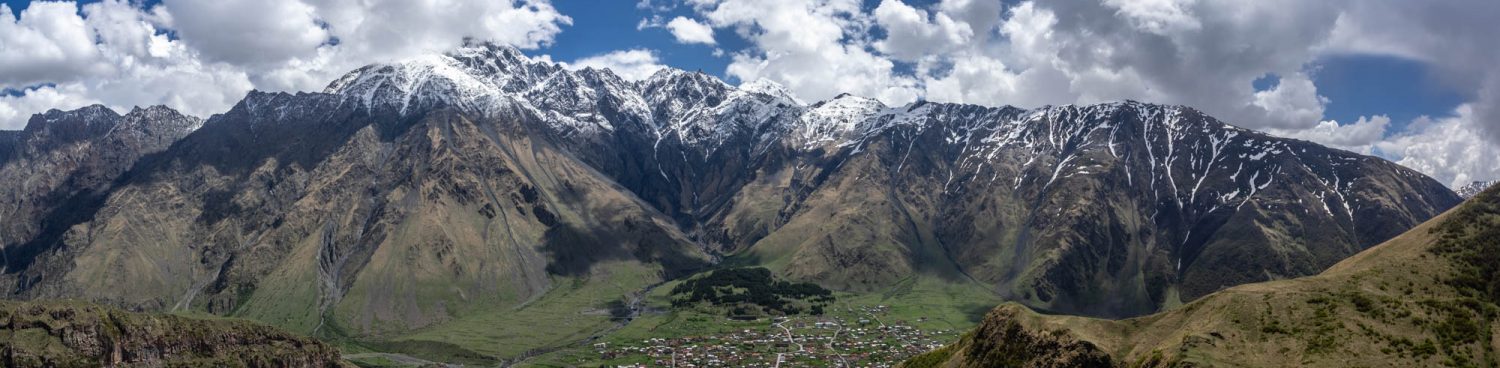
Forgotten World Hwy view. Mt Doom is in the horizon, just left of centre
I found the 12kms of dirt road followed by the infamous single laned Moki tunnel. The tunnel was the only one of 5 built, for the road. Rather bemusingly the rail line that goes along the valley tunnels at each of the saddles the road goes over. What is a bigger shame is this railway line has no passenger services operating on it. NZ has a very extensive railway network, but very few commuter trains and those that do exist are the expensive tourist railways and the link from Auckland to Wellington and Picton to Christchurch with a ferry linking the two.

Moki tunnel
I arrived in Stratford and that marked the official end of the Forgotten World highway, definitely the most scenic drive I’ve been on during this trip in NZ. I was however disappointed that Mt Taranaki was also covered in cloud, whilst everywhere else was clear blue sky. I headed for the Surf Highway to follow the Taranaki coastline around to New Plymouth from the south. Its a region mostly known for surfing, however, I did want to see the Egmont Lighthouse. The mountain also used to be called Mt Egmont, after Captain Cook named it for the Earl of Egmont. However as has happened, place names have reverted back to the Maori name. The lighthouse though (and also the national park) are modern namings and have retained the Egmont name.

Egmont Lighthouse and a shrouded Mt Taranaki
The rest of the Surf highway was fairly uneventful. I went searching for a wreck, but failed to find it and thus continued on into New Plymouth. My motel has recently been done up and is very swish indeed, probably the best motel I’ve ever stayed in. Tomorrow is a long drive back to Wellington, with nothing much planned to see, but the journey may offer some highlights

Taranaki coastline